
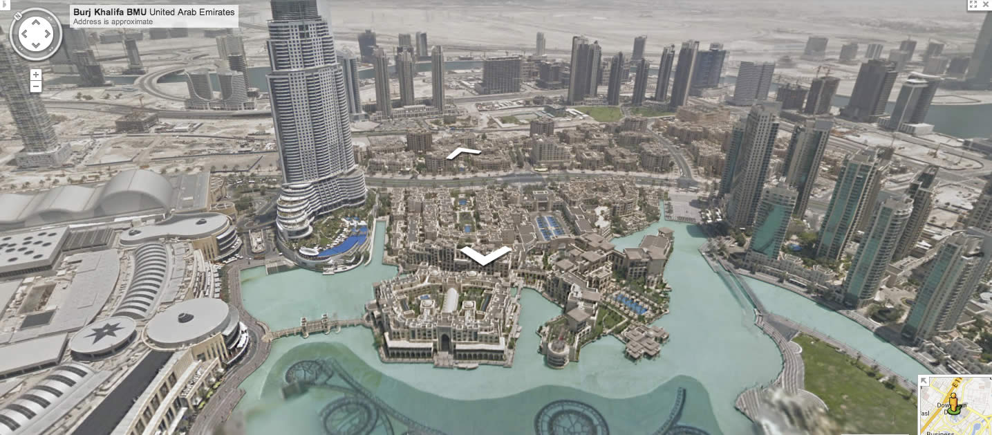

The world’s tallest building, the Burj Khalifa in Dubai, is now available on Google Maps with Streetview, allowing users to explore all 828 metres of the skyscraper with panoramic imagery.
In an announcement on the Google Blog, the search giant announced
This is the first time we’ve captured a skyscraper on Street View—making Google Maps even more comprehensive and useful for you. The imagery was collected over three days using the Street View Trekker and Trolley, capturing high-resolution 360-degree panoramic imagery of several indoor and outdoor locations of the building.
In addition to the breathtaking views from the world’s tallest observation deck on the 124th floor, you can also see what it feels like to hang off one of the building’s maintenance units on the 80th floor, normally used for cleaning windows!
These views of the Burj Khalifa follow an update to Street View earlier this month, where Google Maps added panoramic imagery of 1,001 new destinations across the globe. To view these images through Street View, users need to visit Google Earth or use the Google Maps app for Android or iPhone (which you should be using anyway!).